
For partners · Pilot
The evidence check, inside your app.
TourenUp checks a route against public records and closures, way by way, and says how sure it is. We are opening it to a few partners for a pilot.
What a partner gets
Two ways in.
The answer
What the answer looks like.
A check of one route, drawn and as data. The route and its numbers are invented.
- Tarmac152 km
- Public way by the records41 km
- Not confirmed49 km
- Private or closed31 km
- Not covered yet286 km
560 km · 152 km tarmac · 121 km dirt in our data · 286 km not covered yet. Of the dirt: 34 % public way by the records · 41 % not confirmed · 25 % private or closed.
- Public way (land record)km 12.4 to 13.6Chemin rural on the land registry.DGFiP via Etalab · July 2026
- Not confirmed: not read yetkm 88.8 to 89.3Inside a national park core: its rules not read yet.MNHN/INPN protected areas · September 2026
- Private waykm 141.0 to 143.2Crosses private land on the land registry.DGFiP via Etalab · July 2026
Signs on site decide.
{
  "lengthKm": 560.0,
  "pavedKm": 152.1,
  "dirtKm": 121.2,
  "notCoveredKm": 286.3,
  "groups": { "public": 41.0, "unknown": 49.3, "against": 31.0 },
  "stretches": [
    { "fromKm": 12.4, "toKm": 13.6, "status": "PUBLIC_STRONG",
      "reason": "Chemin rural on the land registry",
      "source": "DGFiP via Etalab", "date": "2026-07" },
    { "fromKm": 88.8, "toKm": 89.3, "status": "UNKNOWN",
      "unknownKind": "not_read",
      "reason": "Inside a national park core: its rules not read yet",
      "source": "MNHN/INPN", "date": "2026-09" }
  ],
  "note": "Signs on site decide."
}
Coverage
Where it works.
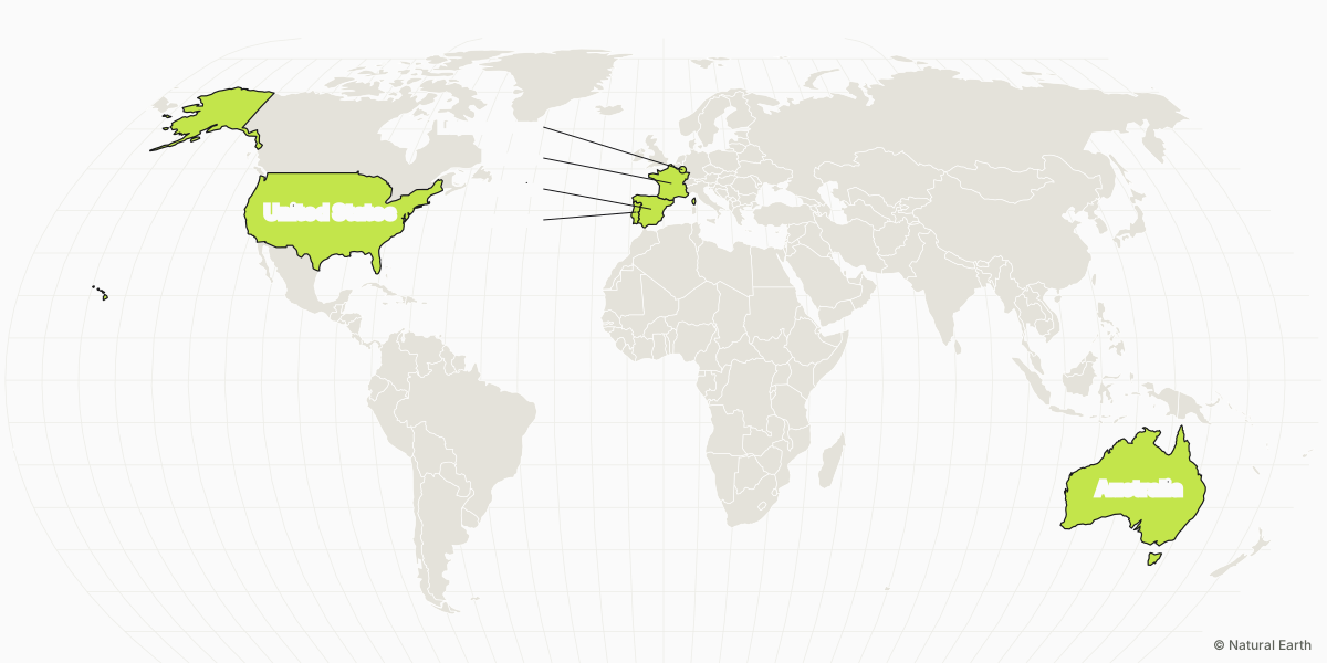
The pilot covers six countries: France, Luxembourg, Spain, Portugal, the United States and Australia. Outside them the answer says that we have no data there; it never comes back clean.
- France
- Luxembourg
- Spain
- Portugal
- United States
- Australia
Sources
The sources.
The sources our releases use.
- OpenStreetMapLocal mappersAccess tags, barriers, tracks and paths.© OpenStreetMap contributors, ODbL
- IGNBD TOPO, LiDAR HDThe kind of way, and its width and steepness from the laser model of the ground.
- Land registryDGFiP, via EtalabWho owns the parcels a way crosses, and whether it is drawn as a rural way.
- Public forestsONFWhere public forests are, and the forest roads a published plan opens.
- Protected areasMNHN / INPNWhere parks and reserves start and end.
- Closure reportsTourenUp ridersWhat a rider found at the way, and the day they found it.Reports by TourenUp riders
The terms
What partners agree to.
- Show our status, reason, source and date, with “Signs on site decide.” Never turn a status into a promise that a way is open.
- Credit “Evidence by TourenUp” and the data sources.
- The data comes under the Open Database Licence: it contains OpenStreetMap data.
- No resale or redistribution of the answers as a dataset.
- Send us closures your riders report, so every app benefits.
- Pilot terms: free, no service level, rate limits, and either side can stop.
What we do with routes
A route sent to us is checked and not kept beyond the check’s life, never shared, never added to our map.
Questions.
Is a check advice on the law?
No. It reports what public records, closure orders and riders say about each way, with the source and the date. Signs on site decide.
Which countries?
France, Luxembourg, Spain, Portugal, the United States and Australia. Outside these, the answer says we have no data there.
What does it cost after the pilot?
The pilot is free. We have not set a price for after it. We will talk it through with each partner before the pilot ends.
How accurate is it?
A record can be out of date and a barrier can go up the day after, so where we cannot confirm a way, the answer says so.
Can we use our own route files?
Yes. You send your own route and we check that copy. We do not keep it beyond the check, share it or add it to our map.
How do we report a mistake?
Send it with the closures your riders report, or write to dev@touren.tech. We answer in writing with what we changed.